|
| Home | Contact | Membership | Members | Firms | ASPNG Congress | Publications | Technical Support | Education | Links |
|
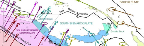
PNG94 is the gazetted national datum for Papua New Guinea (National Gazette of 22 May 1996). EPSG Code 5544 PNG94 is realised by the coordinates of 14 zero order geodetic stations within Papua New Guinea (listed below) related to the International Terrestrial Reference Frame 1992 (ITRF92) at epoch 1994.0 (same as GDA94 in Australia). PNG94 supersedes AGD66 as the national geodetic datum for Papua New Guinea. Transformation parameters between AGD66, PNG94 and WGS84 can be viewed here It is defined as follows: Reference Ellipsoid: GRS80 Map Projection: Papua New Guinea Map Grid 1994 (PNGMG94) Projection type: Universal Transverse Mercator (UTM) Usage: PNG94 should be used as the geodetic datum for all cadastral, topographical, engineering and resource sector surveys commenced after 2000. Access: Surveys should be connected to the nearest high order PNG94 control. This can be by means of connection to a PNG94 coordinated monument, or to a CORS station. Because of the highly complex tectonic setting in PNG, the closest coordinated monument should be used for connection. First Order Coordinate Listing: Click on the link PNG94 1st order adjustment 2008 (update 1st December 2011) to view and download the spreadsheet of the current first order coordinate list for PNG94. The adjustment has resulted in small changes in the original zero order PNG94 realisation (listed in the table below). The data area also provided as a Google Earth kml file Site and access information for these stations (and others) are available at the Australian National University Research School of Earth Sciences: PNG GPS Site Information Note that the coordinates in these site logs are ITRF2000 at epoch 2000.0 and may be up to 0.5 m different from the PNG94 values. Using PPP, AusPOS and OmniSTAR with PNG94 - WGS84 guidance: These GNSS precision surveying systems and post-processing services deliver coordinates in terms of ITRF2005 or ITRF2008 and these coordinates will be up to two metres different from PNG94. A block-shift correction to be applied to derived coordinates from these systems can be determined by occupation of the nearest PNG94 coordinated monument. AusPOS delivers both GDA94 and ITRF2008 coordinates for PNG locations South of 8 degrees S latitude. The GDA94 coordinates should NOT be used in PNG as an equivalent of PNG94 because the ITRF2008 transformation parameters used are not valid in Papua New Guinea. WGS84 is not a legal datum in Papua New Guinea because of the absence of WGS84 datum monuments in PNG. WGS84 is closely aligned to ITRF2008. Like ITRF, WGS84 coordinates of fixed features will change by up to several cm a year due to plate tectonics. Coordinate transformations: The map projection for PNG94 is the Papua New Guinea Map Grid 1994 (PNGMG94). PNGMG94 is a UTM projection (Southern Hemisphere) with three Zones: PNGMG94 Zone 54 (west of 144 degrees E) EPSG Code 5550 PNGMG94 Zone 55 (between 144 and 150 degrees E) EPSG Code 5551 PNGMG94 Zone 56 (east of 150 degrees E) EPSG Code 5552 0.5 degree zone overlaps are permissable for projects located on a UTM zone boundary. Since PNG94 and GDA94 share the same realisation, the GDA94 technical manual can be used with PNG94 and PNGMG94 (substitute PNG94 for GDA94 and PNGMG for MGA). The GDA94 technical manual is accessible at GDA94 Technical Manual version 2.3 Datum transformations: Datum transformations between AGD66, PNG94 and WGS84 can be found here . Elevations: PNG Ellipsoid heights are up to 85 metres different from MSL and a suitable geoid model should be used for transformation of ellipsoidal heights to MSL. Refer to the vertical datum page for more information. The PNG94 geoid developed by Prof. W. Kearsley no longer can be used on Windows XP, Vista, or 7. The PNG08 geoid model is recommended to be used in PNG. Due to the large Mean Dynamic Topography of the ocean surfaces around PNG a large correction of between 0.7 and 2.0 metres needs to be subtracted from EGM2008 and EGM96 derived elevations to obtain MSL if the EGM2008 or EGM96 geoid models are used. Datum precision: Horizontal Coordinates have a Positional Uncertainty of 0.04 metres at epoch 1994.0 Ellipsoidal Heights have an uncertainty of 0.10 m Proposed Developments: Densification of PNG94 and improved tidal monitoring around PNG is underway. A readjustment of the network is also proposed during 2015 in order to reduce the uncertainities from 40 mm to 10 mm. A gridded representation of the PNG deformation model to enable conversion from kinematic ITRF2008 to PNG94 coordinates is also under development. Check this web-page for any developments. Technical Questions and enquiries: Contact Richard Stanaway richard.stanaway@quickclose.com.au for any technical information regarding PNG94, transformations and vertical datums. |
Maintained by: Richard Stanaway, Quickclose Pty. Ltd.
Last Updated: 17th December 2014